You are using an out of date browser. It may not display this or other websites correctly.
You should upgrade or use an alternative browser.
You should upgrade or use an alternative browser.
Boating apps
- Thread starter Brian N
- Start date
- Joined
- Sep 16, 2003
- RO Number
- 12212
- Messages
- 12,004
Navionics is great stateside but in the Bahamas their charts are full of errors that will either run you aground or discourage you from going into some great anchorages.
Aquamap on the other hand uses Explorer charts in the Bahamas. It s also very good here in the US. Also has a good anchor alarm
Boat beacon and Marine Traffic are two apps I use as well. Boat Beacon allows you to broadcast online AIS. It is only visible online (not by other vessels using VHF AIS) but it allows friends to see your position
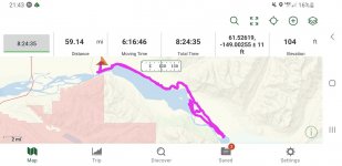
another app I use quite a bit on board is Trails. While not a boating app it lets you record your tracks along with speed. I use it a lot whether while biating, sailing, driving, hiking, horseback riding etc. works in the background so once you start it, you can use the phone for anything else.
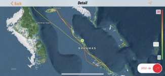
here is a screen shot of a 6 weeks bahamas trip a couple of years ago. I can zoom in from the app and check out every detail like anchorages we went to


